CAREERS
Coastal and Marine Geologist
The United States Geological Survey (USGS) serves to provide scientific information to describe and understand the earth, which helps reduce the loss of life and property when natural disasters hit and helps us manage our natural resources. The USGS employs 10,000 scientists and technicians who collect, monitor, and analyze scientific data about the land and sea and share what they have learned with the public through maps, reports, video, posters, and other published materials.
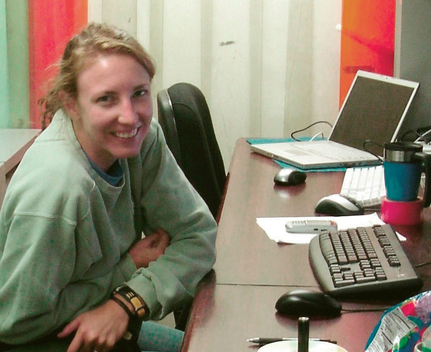
Fieldwork takes Elizabeth to sea on research vessels but not necessarily away from a computer and lab. Here, Elizabeth sits inside a computer lab aboard ship and processes data they just collected during a USGS seafloor mapping research cruise.
Elizabeth Pendleton is a geologist for the USGS in Woods Hole, Massachusetts, on Cape Cod. She works in an office that studies coastal and marine science, and her specialty is coastal geology. Coastal geologists try to learn more about the land, processes, and hazards that exist where land and sea meet—the seaside. By learning more about what kinds of things affect our shores and how those things affect them, we can make better decisions about how we use our coastal areas, which is important to human safety and the environment. Hurricanes, tsunamis, earthquakes, and climate-related issues, such as sea-level rise and beach erosion, are just a few of the topics that coastal and marine geologists address.
Most of the projects Elizabeth works on can be broken into two parts—data collection and data analysis. To collect data, coastal and marine geologists have to do fieldwork, which for Elizabeth usually means going out on a research vessel and using scientific instruments to map the seafloor, collect samples, or measure properties of the water or sediment along the beach and underneath the water. For her job, she might spend anywhere from two weeks to three months of a year in the field. The rest of the time, she works in her office on Cape Cod, analyzing the data on a computer and writing up the results of what they learned in reports and presentations.
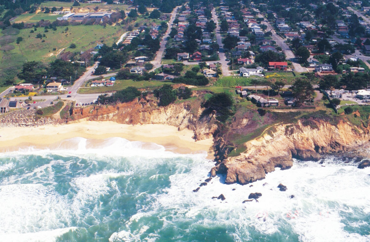
In Montara, California, neighborhoods are built right up to the cliffs that separate the houses from the powerful Pacific Ocean waves. Knowledge of beach erosion and coastal processes is important to protect people’s property and to prevent others from developing land in environmentally sensitive areas. Photos courtesy USGS.
“My favorite part of being a coastal and marine geologist is the fieldwork. Every trip is different, but I always get to travel, learn, and see new things. For my first project at USGS, I visited 20 national parks in the United States, including those in Alaska, Hawaii, American Samoa, Guam, and the US Virgin Islands. We were trying to assess how vulnerable our coastal national parks are to sea-level rise in the next 50-100 years, and my task was to map coastal landforms and areas where they have been eroded. Many of these areas are hard to reach by land, so we traveled to them by boat and by plane. In addition to visiting some beautiful coastal landscapes and meeting some incredible people, we encountered wild animals—both on land and in the sea—I’d never seen before. I can’t think of what other job would give me this opportunity. I grew up in Tennessee, but my favorite family vacations were at the beach. I liked to collect shells and play in the waves, so, in a way, I started studying the coastal environment even then. We had to drive 8-10 hours just to get to the beach, so I decided that I needed to live closer to the ocean when I grew up. When I was in high school, I applied to colleges that offered marine science degrees. After checking out marine biology, chemistry, geology, and oceanography, marine geology just seemed to click for me, and my advisor encouraged me to continue on to graduate school, where I earned a master’s degree.” —Elizabeth Pendleton
You can learn more about research projects at the USGS in Woods Hole, MA, by visiting: https://woodshole.er.usgs.gov.
Did You Know?
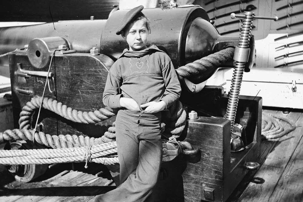
The Age of Sail was said to be the domain of “wooden ships and iron men,” but sailing ships also had boys on their official crew lists.
Today, you have to be 14 years old before you can get a job in most states in the US, but in the Age of Sail both merchant ships and navy vessels signed on boys as young as seven years old as regular members of the crew.
What were these kids doing on board sailing ships?

